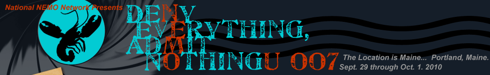


Agenda
- Pre-Conference
- Day 1
- Day 2
- Day 3
- Print-friendly Agenda
The Hub is not planning any official pre-conference events due to the unique opportunity U7 attendees of participating in the Sea Grant Working Waterways and Waterfronts Symposium (Visit the U7 Register section to learn more about options for attending both the Working Waterways and Waterfronts and NEMO U7 conferences). We have collected some links and information on the Portland area if you are interested in site-seeing on your own. Please contact kara.bonsack@uconn.edu if you know an awesome must-see/visit location in the greater Portland area that we have missed!
Tuesday, September 28, 2010
Attend Sea Grant Working Waterways and Waterfronts Symposium (single-day registration is available) Explore Portland! Visit the U7 Area Attractions Section for more information. 5 PM Pre-registration Begins 6 PM Meet in Portland Regency Hotel's Armory Lounge for Dinner Outings (optional, of course!)
Wednesday, September 29, 2010
| 8 AM | Registration | ||
| 8:30 AM | Plenary Session | ||
| Welcomes: Dave Dickson, National NEMO Network Coordinator, Vicki Carrasco, Sea Grant Sustainable Coastal Community Development Network & Art Gold, Univerisity of Rhode Island | |||
| Host State Address: LaMarr Clannon, Maine NEMO | |||
| State of the Network Address: Dave Dickson, National NEMO Network Coordinator | |||
| 10 AM | Break | ||
| 10:15 AM | Plenary Session | ||
| Stormwater in the City | |||
|
The Latest in Urban Stormwater Practices: Rich Claytor, Horsley Witten Group
Abstract
New England has been settled for a long time, and is also pretty set in its ways. So, when it comes to stormwater, there is a lot of retrofitting and redevelopment to be done. You can’t travel far in the region without (literally) running into Rich Claytor, P.E. and a Principal of the Horsley Witten Group, a prominent environmental science and engineering firm in New England. HW works on a wide range of projects involving stormwater management, smart growth, low impact development, and wetlands protection. As the main man at HW for many of these projects, Rich has quite a lot of examples to relate, and stories to tell, of the good, bad, ugly and innovative aspects of working on stormwater management in urban communities. Although Rich is more often compared with Maxwell Smart than James Bond, we thought it was close enough.
The Fate of the First Impervious Cover TMDL in the Nation: Chet Arnold, UConn CLEAR & Kelly Collins, Center for Watershed Protection Abstract
In 2007, the Connecticut Department of Environmental Protection promulgated the first Total Maximum Daily Load (TMDL) in the country based on impervious cover—smack dab on the University of Connecticut campus. The TMDL was developed as a way to deal with “urban stream syndrome”—streams compromised by a concatenation of contemptible urbanization-related impacts. What does an “Impervious Cover TMDL” mean? Will the mixing of a technically based pollutant accounting system with a general landscape indicator be like oil and water, or lobster and melted butter? This talk will relate the status, findings, and results to date of the ongoing Eagleville Brook project. Ponderings on pavement, ruminations on retrofits, and musings on mechanistic modeling versus outreach-oriented organizational frameworks will be offered. Progress has already been made, and don’t tell anyone…but we think it’s working.
Long Creek Overview: A Creative Local Effort to Fund and Carry Out Restoration of an Urban Watershed: Curtis Bohlen, Casco Bay Estuary Partnership Abstract
The "Clean Water Act" (CWA) has been remarkably effective reducing the impact of discharges from industrial sources and wastewater treatment facilities. It has been less effective dealing with the insults to surface waters from urbanization. A three year effort in the Long Creek watershed, near Portland, Maine has culminated in creation of the Long Creek Watershed Management District (LCWMD), a public-private partnership to support stormwater management and urban stream restoration. EPA recently announced that it would use "Residual Designation Authority" to require Long Creek landowners with over one acre of impervious cover to obtain CWA permits. Complying with this new obligation could have cost businesses thousands of dollars per acre of asphalt. The LCWMD solution offers a less expensive alternative while it facilitates urban watershed restoration. The creative approach used in Long Creek offers a potential tool for addressing stormwater in urban and suburban watersheds nationwide. |
|||
| 12 PM | Lunch on Your Own | ||
| 1:30 PM | Concurrent Sessions (2) | ||
| Reiterating & Retooling NEMO | |||
| 1:30 | 2:00 | 2:30 | |
A Case of Changing Identity: New Hampshire’s Natural Resource Outreach Coalition (NROC):Julia Peterson, NH Sea Grant & Steve Miller, Great Bay National Estuarine Research Reserve Abstract
After about 10 years in existence, the NH NEMO program (aka NROC) has had to adjust to external pressures. The Coalition is made up of ten organizations and agencies that provide education, technical assistance and facilitation to community boards and municipal officials looking to improve land use decisions and their effects on water resources in New Hampshire’s coastal watershed. As the number of applications for assistance diminished, volunteer fatigue and financial strain in communities increased and funding sources shifted, the Coalition found itself having to make changes in its approach to communities. Fortunately, one of the Coalition partners, Piscataqua Region Estuaries Partnership, recently conducted a broad inventory and assessment of the natural resource based regulations and policies within the region. The Assessment provides information about what natural resource protection policies and regulations a community has and how that compares to other communities within the watershed. The assessment, the Piscataqua Region Environmental Planning Assessment, is providing a calling card and launching pad for NROC members to work with communities. Come learn how one program breathed new life into its community work and consider how your community work might benefit from others’ experiences. |
Dr. NEMO: When The Prescription is Education, What’s a Municipal Official To Do?: Lorraine Joubert & Lisa DeProspo Philo, RI NEMO Abstract
In 2005, RI NEMO began working with municipalities across the state on the topic of stormwater pollution. Our primary goal has been to develop educational materials and delivery methods that Rhode Island municipalities and other MS4s could use to meet their Phase II requirements. Most notably, we have been helping municipal officials to develop education strategies based on local water resource issues so that they can carry out the education themselves. Over the course of the last five years, we have met with mixed success. We would like to share not only the materials that we have created but also the range of our experience, from examples of municipalities that have embraced their additional roles as public educators to those who have not. We hope to highlight the special challenges and opportunities associated with the task of asking municipal officials to become educators, and engage participants in discussion of their own experiences.
|
Helping Communities Reach Watershed Goals – Regional Water Quality Asksistance Network: Eve Brantley, AL NEMO Abstract
A desire to implement educational and on-the-ground projects to make a difference in watershed health is a common theme in communities where water quality has been identified as a priority. Often, the stumbling block to putting practices into action is a lack of expertise. To address this issue, a multi-state, interdisciplinary team was awarded an EPA Targeted Watershed Grant, Southeast Regional Water Quality Assistance Network. This project provided a variety of technical assistance to selected communities around the southeast. Communities completed an application that detailed their needs in four main categories: 1) Financial Planning and Assistance, 2) Water Quality and Watershed Management, 3) Watershed Planning and Participation, and 4) Project Implementation. The communities were then matched to the partner(s) that could best provide expertise to achieve local goals of protecting or restoring local water quality. This presentation will provide an overview of lessons learned from spotlight communities including Little River Canyon Watershed, Alabama, Soquee River Watershed, Georgia, Lenoir, North Carolina, and the City of Jasper, Alabama. |
|
| Water Runs Through It | |||
| 1:30 | 2:00 | 2:30 | |
Quantum of Buffer: Emily Wilson, CT NEMO, CLEAR & Juliana Barrett, CT NEMO, CT Sea Grant Abstract
Land cover data from the Center for Land Use Education and Research was used to assess land cover and land cover change within riparian corridors of Connecticut. Two buffer areas, 100ft and 300ft, were each defined by the distance on either side of a stream or from a shoreline. Each buffer area was characterized for both 2006 land cover status and 1985-2006 land cover change. The results of this analysis directed attention to several watersheds within the state in which development within the 300ft buffer had increased significantly between 1985 and 2006. The Niantic River Watershed in southeastern Connecticut is now the focus of a four town riparian buffer program. Workshops for municipal officials in each of the towns within the watershed focused on buffer functions and values, including their role as a climate change adaptation strategy, with a goal toward influencing local policies to include riparian buffer guidelines. |
Mission: For Your Streams Only: Jessica D’Ambrosio, Andy Ward & Jonathan Witter, OH NEMO Abstract
The Take: While you might have thought the Ohio NEMO Program had become a devised facility in the last few years, our operatives have been in deep cover investigating local needs, new topical directions, and innovative tools and resources…. By keeping our cover until now, we have ensured plausible denial from all affiliates. There has been much black propaganda dis-informing us that stream systems should not have a key role in land use protection strategies. Ohio NEMO operatives have recovered a valuable communications device to help municipal officials understand and assess stream and watershed systems, better prioritize sites for protection and/or enhancement, and choose appropriate enhancement strategies. This web-based, multi-media communications device is freely available and can be adapted to any state or region. Its full contents will be leaked to the public June 2010. We have provided you with a small part of the contents. Knowing too much too soon could be dangerous. Current dead drop location (subject to change without advanced notice to protect site contents): streams.osu.edu/module1/mod1.html This device is part of a larger effort to re-instate the NEMO for Streams Program (aka: STREMO): A highly adaptable program that puts the focus back on streams systems and the ecosystem services they provide as part of a comprehensive land use strategy. The Target: 7…U7. Should you choose to accept this mission, you are our target of opportunity to adapt the program to multiple NEMO stations. |
You Sank My Nitrogen!: Adding Nitrogen Assessment & Control to Coastal NEMO Programs: Art Gold, University of Rhode Island, Q. Kellogg, University of Rhode Island, Melinda Shimizu, Arizona State University, Dept. of Geography, Elizabeth Wentz, Arizona State University, Dept. of Geography, Kelly Addy, University of Rhode Island & Chet Arnold, UConn CLEAR Abstract
If your NEMO territory is close to where the land meets the sea, and maybe even if it’s not, your target audience has probably been inundated by a raft of state and federal officials, coastal ecologists and watershed hydrologists with a relentless diatribe on the evils of nitrogen (N). However you feel about their smug little N clique, we all know that impervious cover is not the whole story when it comes to water resource protection. So maybe somewhere far, far, away (or just 2 states south), there are NEMO people who can share straightforward GIS approaches to N assessment, restoration of buffers, wetlands and streams, as well as control methods for septic systems, storm water and small farms that can be easily implemented by local communities. Nitrogen assessment and control no longer needs to be a guessing game—your coastal managers will knowingly exclaim “You sank my Nitrogen!” Come hear about a new modeling tool that estimates and locates watershed sources or sinks for that evil nitrogen—helping to target riparian, stream and reservoir protection efforts and subsequently maintain or improve critical coastal water resources. |
|
| 3 PM | Break | ||
| 3:15 PM | Concurrent Sessions (2) | ||
| Partners in Crime | |||
| 3:15 | 3:45 | 4:15 | |
The World (& Data) is Not Enough: Danielle Bamford, Stephanie Beard, Adrianne Harrison & Nate Herold, NOAA Coastal Services Center Abstract
More than just data, the Digital Coast is a network of diverse partners working together to address the priority coastal issues of coastal conservation, hazards, land use, marine, and water quality planning. The Digital Coast, designed by Q, was envisioned as an information delivery system that could efficiently serve not only data, but also the training, tools, and user case studies. The purpose of this session is to demonstrate all of Digital Coast’s top secret features that are relevant to the NEMO programs (with super secret security clearance) and land use planners. The Coastal Inundation Toolkit is a specific example of how the data, tools, and other information within Digital Coast can help assess flood risks in your communities, all while defeating the evil Dr. No. For more information, visit www.csc.noaa.gov/digitalcoast. |
An Undercover Agent’s View of Community-based Watershed Management in Hawaii: Jolie Wanger (Hawaii Sea Grant), Carol Wilcox & Alyssa Miller (Mālama Maunalua) NERRs Abstract
Hawaii Sea Grant has embedded a NEMO operative (Extension Agent) within the ranks of a local community organization (Code Name: Mālama Maunalua). Mālama Maunalua has quickly established itself as a leading force in the fight against impervious cover (code-IC) and other crimes that have resulted in the near death of Maunalua Bay. Three major interrelated threats (land-based pollution, overharvesting, alien algae) are being addressed. Thus far extensive research, community removal of alien algae leading to a federal stimulus grant for large-scale removal, and important steps towards stormwater remediation in partnership with the Army Corps of Engineers have occurred. The Extension Agent and her associates have commenced an investigation of IC and other watershed crimes, adapting established protocols to the local situation and employing cutting-edge gadgets. They are working to initiate Low Impact Development (code-LID) pilot projects, workshops, and train a cadre of agents to provide “house-call” services for stormwater improvements.
|
Go Ahead… Make My Day - the NERR Coastal Training Program & NEMO Friends or Foe?: Dr. Christine Feurt, Wells NERR, Maine & Jennifer West, Narragansett Bay NERR, Rhode Island Abstract
The Coastal Training Program of the National Estuarine Research Reserve System is actively engaged in 27 coastal states working with communities to improve land use practices, manage stormwater and protect habitat. Sound familiar? It should since CTP partners with NEMO in many areas. How does CTP compare to NEMO? CTP Coordinators from Maine and Rhode Island will share “the good, the bad and the ugly” aspects of work with municipal land use planning in the northeast that differs from and augments a traditional NEMO approach. Social science research to understand municipal official perceptions of water and pollution; development of conservation planning documents; use of audience poling devices, and application of innovative Community Viz technology will be presented. |
|
| Tools from the Mind of NEMO | |||
| 3:15 | 3:45 | 4:15 | |
CRIs Like Us: Emily Wilson, CT NEMO; Greg Bonynge, RI NEMO; Jesse Schomberg, Northland NEMO; Dan Hitchcock & April Turner, SC NEMO; and Patrick Beggs & Christy Perrin, NC NEMO Abstract
One of the cornerstones of CT NEMO's outreach to land use officials and planners has long been the Online Community Resource Inventory Tool. The tool takes much of the pain out of the critical first step in natural resource based planning - conducting a resource inventory. It provides a resource inventory for each of CT's 169 towns to anyone with a web browser and an internet connection. While simple, it is one of CT NEMO's most effective tools. With funding from CICEET (the Cooperative Institute for Coastal and Estuarine Environmental Technology), we launched an effort in 2007 to help other states in the NEMO Network develop their own versions of a an online CRI. This session will feature each of those adaptations and demonstrate how each created their own morph on tool. A great opportunity for you to learn about different approaches to building an interactive and effective resource inventory or other web mapping tool.
|
Bonding With Your Watershed: The Northland NEMO Watershed Game: John Bilotta, Jesse Schomberg, Cindy Hagley, Julie Westerlund, MN, Northland NEMO, Susan O'Halloran, University of Wisconsin Extension & Amy Eliot, Lake Superior Research Institute. Abstract
The Watershed Game is a highly interactive tool developed by Northland NEMO to build the level of understanding, knowledge, and skills of local elected and appointed leaders. Participants learn how a variety of land uses impact water and natural resources, increase their knowledge of BMPs, and learn how their choices can prevent adverse impacts. Participants apply plans, practices, and policies that help them achieve a water quality goal (aka TMDL) for a stream, lake, or river. In the first part of this session, NEMO colleagues will discover how this tool has been used in NEMO programming and learn about the effectiveness of this tool through evaluation data that has measured knowledge and skills gained and participant’s actions or behaviors changed. The second part of the session will take place on the evening boat trip and involve a full run-through of the game, including set up, rules, game management techniques, and wrap-up, to provide participants with a full comprehension of the activity and help them determine how this could be useful in their own NEMO programs. This is a tool James Bond never had and all NEMO educators can use!
|
||
| 4:45 PM | Prepare for Boat Trip & Group Photo | ||
| 5 - 8 PM | Casco Bay Lighthouse & Islands Tour on the Island Romance (see Events page for details)
|
||
Thursday, September 30, 2010
| 8:30 AM | Symposium: Hybrid Approaches to Sustainable Land Use Planning & Regulation, Randall Arendt Randall's Bio
|
||||
| 10:15 AM | Break | ||||
| 10:30 AM | Concurrent Sessions (2) | ||||
| Site Design/LID | |||||
| 10:30 | 11:00 | 11:30 | |||
| Stealth Stormwater Solutions: Allowing LID to Infiltrate Reluctant Oregon Communities: Robert Emanuel, Derek Godwin, Frank Burris, Megan Kleibacker & Teresa Huntsinger, OR NEMO Abstract
Low Impact Development approaches have been embraced in some larger communities that face state-regulated water quality issues such as combined sewer overflows and significantly impaired water quality near urbanized areas. Encouraging stormwater managers in many smaller (and some larger) communities to employ low impact development approaches means using a whole suite of educational subterfuge. Beginning in 2008, Oregon State University and Oregon Environmental Council teamed up to produce Stormwater Solutions workshops to help these ideas infiltrate more reluctant Oregon communities. We will present what we have found to be the keys for working with these communities to create on-the-ground demonstrations, unique trainings, and technical assistance tools. A few examples are: transforming local contacts into partners, being persistent and yet remaining flexible, and demonstrating small but measurable successes before attempting more ambitious change. This presentation will provide both ideas and strategies that NEMO Network members can secretly incorporate into their programs to encourage the adoption of LID-focused strategies in many types of communities.
|
Decoding LID and Recruiting Secret Agents for Change in Maine with Counterinsurgency for Coastal Communities: LaMarr Clannon & Fred Dillon ME NEMO Abstract
Our creative partnership started with real barriers (lack of exposure/expertise) and perceived barriers (just ‘cause it works in NH doesn’t mean it’ll work here) to incorporating LID in projects in NNE. Several rounds of outreach, education and evaluation have led to tangible results and a less turbid path forward. Tangible results include adoption of stormwater ordinance, LID used on individual projects, engineers vocal support of the NEMO program as an agent for change (in front of our major funder-oh yeah!), and a majority of workshop attendees claiming that they will use something they learned to incorporate LID in their communities. One project to highlight is South Portland’s efforts to develop a LID guide specifically designed for the unique characteristics of coastal communities. This will be a “user-friendly” online resource that will benefit small commercial and residential development and redevelopment projects constrained by coastal soils throughout southern Maine. Partners: EPA region 1, Vermont NEMO, Maine NEMO, NH NROC, University of Maine Cooperative Extension, Casco Bay Estuary Partnership, City of South Portland, Maine DEP Nonpoint Source Training Center etc…. |
Live and Let Live: Finding Common Ground Between Emergency Safety Needs and Effective Stormwater Management: Monique Myers CA WALUP & Timothy Lawrence, Washington State University Extension Abstract
Street width and carrying capacity of permeable pavement and bioretention features are common concerns of fire safety and other emergency safety professionals. Since local decision makers need to give precedence to safety concerns and access over environmental benefits, implementation of low impact development (LID) features can be derailed if emergency safety personnel are not confident the features will adequately support their needs. To fully understand the needs of both emergency safety personnel and requirements of city/county planners regarding LID implementation, we convened focus groups and personal interviews with stakeholders from both groups in Ventura County, the cities of San Ramon and Davis, California. A publication resulted from this work Davis CA Fire Chief described as “…the most equitable treatment of the topic I have seen to date." The methodology may be useful for implementation in other parts of the US and is already in use in California, Oregon, and Washington Cooperative Extension and Sea Grant programs to facilitate discussion with local emergency services organizations. |
|||
| Tools | |||||
| 10:30 | 11:00 | 11:30 | |||
Bringing Covert Land Use Strategies into the Spotlight: Cracking the Code for Sustainable Communities: Daniel R. Hitchcock, Baruch Institute of Coastal Ecology & Forest Science, Clemson University Abstract
As our population grows, so does the area of changing land use required to meet the demand. The conversion of forested areas to urban development, if mismanaged, could lead to detrimental impacts to and irretrievable losses of resources. A natural resource-based strategy should be the first step toward sustainable land use change. It’s no easy mission -watershed and landscape characteristics vary with respect to hydrology, soils, vegetation, wildlife, and society. These elements often extend beyond and occur between geopolitical boundaries; therefore, holistic decision-making must consider these complex resource elements within and between their differing levels of scale. Community officials and other professional decision-makers need readily-accessible and easily-interpreted information about hydrological, ecological, historical, and cultural parameters for effective short- and long-term sustainable development, including considerations for climate change and community resilience. This presentation will focus on integrated research and extension programs designed to guide sustainable land use in coastal South Carolina. A major challenge is water quantity management where the landscape is typified by flat topography, a shallow water table, and surface/groundwater interactions where wetland habitats prevail. Evapotranspiration is a major natural mechanism by which water quantity is managed, while vegetation also allows for soil stabilization and pollutant removal. Specific integrated research and extension programs will be discussed, including (1) the Online Community Resource Inventory (CRI), a web-based mapping tool (regional and county scale); (2) the Intelligent River ™ monitoring and data visualization project on the proposed 1400-ha coastal development tract Bannockburn Plantation (development site scale), and (3) the Baruch stormwater management demonstration project (individual LID practice scale). These programs offer science-based knowledge to inform decision-making through online maps and tools, LID demonstration sites, and workshops related to each of these program elements while creating hydrological, ecological, and community-based pre- and post-development benchmarks for sustainable land use goals. |
Conservation Subdivision Design: A Planning Tool to Mitigate the Impacts of Development on Natural Resources: Sean D. Rafferty & David A. Skellie, PA NEMO Abstract
One of the planning tools used to mitigate the impacts of development is conservation design. Conservation design allows communities to preserve networks of open space by promoting the construction of conservation subdivisions in place of conventional subdivisions. Benefits of preserving open space through conservation design include: protects streams and water quality, provides habitat for plants and animals, provides recreational opportunities, often reduces costs of municipal services, increases profit margin for developers, etc. This presentation will detail two conservation design efforts in the Erie Region: the proposed 63-acre Crown Point Conservation Subdivision in Millcreek Township, including land development and cost comparisons between the originally planned conventional development and the conservation subdivision; and in Harborcreek Township, the development of standards (requiring amendments to all three of the Townships planning documents) that would facilitate new conservation residential subdivisions.
|
Stealthy Approaches to Buffer Education - What Would Q Think?: Susan Donaldson & Steven Lewis, University of Nevada Cooperative Extension, Genie Azad, Carson Water Subconservancy District & Abstract
Riparian buffers in the Great Basin are substantially different in character from those in much of the United States. Many have been impaired by agriculture, overgrazing, development pressures and climatic extremes. The NEMO Nevada program has begun to develop a riparian buffer education program aimed at raising awareness of the structure and functions of these areas, and options for preservation. However, we find that residents are wary of efforts to protect these areas, and often do not understand their functions. We focus on several stealth elements, including a section on western buffers and approaches to buffer preservation on our website, www.unce.unr.edu/nemo. We’ve also authored a searchable database of plants that can be used in low impact development (LID) projects that includes appropriate riparian plants. In 2009, we launched a video contest for middle and high school students. The goal was to increase understanding of the role of riparian areas in water quality protection while encouraging the students to use social networking to get others to watch their videos. The theme for the contest was: How Carson River riparian areas benefit you and your community, and how to get people involved in riparian area preservation. Teens were invited to create and upload to YouTube a 1- to 3-minute-long video or animated slide show focusing on the theme. Winners received cash prizes and had their presentations featured at a film festival and in print media. A prize was awarded for the most-viewed video in YouTube, as well as the audience “popular vote” at the film festival. The final component of the buffer education program includes a series of focus groups, scheduled for October, that will probe residents’ understanding and valuation of riparian buffer areas and help guide us in the production of relevant educational materials and events. |
|||
| 12 PM | Box Lunch | ||||
| 12:30 PM | Field Trips (see Events for Details)
|
||||
| 4:30 PM | Roll Your Own Discussions
|
||||
| 7 PM | Maine Family Lobster Bake on Peaks Island (see Events page for details) Since we are in Maine, for the U7 NEMO Family Dinner we of course had to fit in a Downeast Lobster Bake. Take the Casco Bay Ferry to Peak's Island for a traditional Lobster Bake at the Historical 5th Maine Regiment Hall. The food (see menu) will be great, even if you are a vegetarian or just hate lobster (chicken and vegetarian burgers will also be served). The views will be spectacular. But the comradery with your fellow agents will make it a conference highlight. Don't miss it! |
||||

Friday, October 1, 2010
| Plenary Sessions – Climate Change Adaptation from the NEMO View | |||
| 8:30 AM | Climate Change Through a NEMO Lens |
||
| 10:00 AM | Break | ||
| 10:15 AM | From Al Gore to Local Regulations: Case Studies in Working with Local Officials on Climate Change |
||
| 12 PM | Lunch on Your Own | ||
| 1:30 PM | Concurrent Training Workshops | ||
| Forging the Link Between LID Research and Land Use Decisions
Todd Janeski, Robert Roseen & James Houle, University of New Hampshire Stormwater Center & Michael Simpson, Antioch University Abstract
Forging the Link is a training for NEMOids and other educators that focuses on articulating the critical economic connections between Low Impact Development (LID) planning and
Historically, the incentives for use of low impact development have been narrowly limited to water quality improvements; however, the message should be far broader. This training brings a body of quantitative information that articulates to local officials the economic and public safety incentives for adoption of LID. This project was developed following a regional partnership approach, which could have widespread transferability to a range of municipal interests nationwide and become an important element to addressing barriers to the implementation of more effective stormwater management strategies. Overall, the training will present information and materials that advance these major objectives:
The training will present sample seminars on LID, Economics of LID (Site design and to address CSO management), and LID as a Climate Change Adaptation Strategy, with case examples. A canned presentation and resource materials that you can adapt to your state accompany the workshop. This workshop will also incorporate a final feedback loop to assist the project team in finalizing the curriculum. The development of this project has utilized various end user outreach and engagement strategies, including surveys and focus groups, to refine content and messaging. At the end of this session, participants will be asked to provide input in the presentation component of the curriculum. |
Never Say Never: You Too Can Create Cool Web Maps Emily Wilson & Cary Chadwick, University of Connecticut CLEAR Abstract
Once solely the province of those lucky few educators who had access to a GIS wizard/sorceress, the emergence of online map browsers like Google Maps have made the creation of engaging web map tools available to all. This hands-on workshop will teach you how to take your data, pictures, and information and display them in a Google Maps Mashup. You will learn how to:
It is a “bring your own laptop” (mac or pc) workshop that requires only a modest level of technical skill, but some prior preparation is required to ensure that attendees have the correct software. Participants should have all of the following prior to coming to the workshop (all are free):
|
Shake Up Your Work with Social Science Brian Eisenhauer, Plymouth State University; Chris Ellis, NOAA Coastal Services Center & Julia Peterson, NH Sea Grant & UNH Cooperative Extension Abstract
In your work as a NEMO/Coastal Community Agent of Change, have you ever wondered –
Maybe tactical training in basic social science would help you answer these and similar questions or help you find the right allies to do so. This workshop is designed to offer just enough background to enable you to choose the right social science frameworks, methods and partners to answer your human dimensions questions. Come to this workshop and walk away with new intelligence, secrets and weapons to improve your programs. |
|
| 4:30 PM | Mission Accomplished | ||
For your convenience, the agenda has been divided into sections. To download a complete, detailed agenda click the Agenda Packet button.
All documents in one - PDF of conference agenda, abstracts and training workshops details. |
|
PDF of conference agenda outline. |
|
PDF of conference abstracts. |
|
PDF of conference training workshops. |