Forests & Land Use Planning
(FREMO) Forest Resources Education for Municipal Officials
It has long been understood that the forested landscape is closely linked to water quality, and, more broadly, the overall ecologic, economic, and public health of our communities. As communities continue to grow and develop, the health of our forest lands is threatened by their conversion to other uses, fragmentation, and division into smaller lots (i.e., parcelization). Because the majority of forested land is privately-owned, the majority of educational efforts seeking to protect the forest resource have focused on individual land owners. It is becoming increasingly apparent that community land use decision makers (the focus of NEMO programs) are also critical to the sustainability of the forest resource.
Enter the NEMO Network’s Forest Resource Education for Municipal Officials (FREMO) project. Launched in 2006 in partnership with the USDA CSREES Forestry Program and the U.S. Forest Service, FREMO is an effort to integrate the forested landscape more fully into the efforts of NEMO programs to assist communities in protecting natural resources through land use planning. The approach is to facilitate the adaptation and development of educational workshops, materials and resources by Network members throughout the country that convey the impacts of forest fragmentation, parcelization, and conversion to local land use decision makers and provide land use planning based solutions for addressing those challenges.
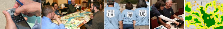
In the fall of 2007 folks from 12 NEMO programs and their partners participated in the Forest Resource Education for Municipal Officials (FREMO) Workshop in Annapolis, Maryland. The workshop featured great discussions on the benefits of forests, the links between forested landscapes and healthy watersheds, and strategies for integrating forest-related issues into natural resource based planning.
Since the workshop, four NEMO Programs have launched FREMO projects of their own, with seed funding from USDA CSREES and the forest service via the Hub. The goal behind these projects is to develop a variety of forest related educational programs and materials that can be adapted by the rest of the Network.
FREMO Pilots
Website Overhaul in process, please be patient.
Landscape Fragmentation Tools (LFT) v 1.0 and v 2.0
Forest fragmentation is becoming an increasingly important issue in the northeast as fragmentation caused by suburban development reduces the ecological and economic value of the region's forest lands. Mapping forest fragmentation can identify areas in which to focus management efforts aimed at minimizing further fragmentation and also allow for better land use planning in the future.
This site provides access to the Landscape Fragmentation Tool v2.0 and its predecessor the Landscape Fragmentation Tool v1.0. Both tools are designed to map the types of fragmentation found in a forests or other landcover types. Both tools require ArcGIS 9.2.
The Landscape Fragmentation Tool v2.0 is based on a procedure to map forest fragmentation that was developed in a recent study (2007) that included participants from the by the U.S. Forest Service and U.S. EPA. The procedures developed are believed to be more consistent and reliable than previous methods for mapping fragmentation at the landscape level. The tool was developed by CLEAR staff and requires the spatial analyst extension for ArcGIS 9.2.
|
The Landscape Fragmentation Tool v1.0 is based on procedures developed in a study by the U.S. Forest Service (2002). The tool was jointly developed through a partnership between CLEAR and Placeways LLC. This tool requires ArcGIS 9.2.
|
Forest Basics
Website Overhaul in process, please be patient.
Links
Website Overhaul in process, please be patient.
We have begun to compile resources that you can use to integrate forest resource protection into your presentations, fact sheets, etc. Many of these are links to materials from other organizations, but we have also added materials from the FREMO Workshop held in Annapolis, Maryland in September 2007.
| Forest Presentations |
FREMO Workshop Presentations
Below are links to all the presentations from the National NEMO Network's FREMO Workshop, which was held in Annapolis, MD, September 18-19, 2007.
If you would like to ask any of the presenters questions or seek permission to use or adapt any of these materials, you can send the presenter an email by clicking on their name below.
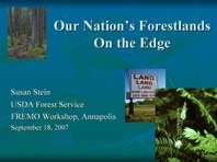 |
State of the Nation's Forests -Susan Stein, U.S. Forest Service: An overview of the national trends regarding development and private forestlands. Based on the Forests on the Edge project. |
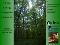 |
Forests 101 - Thomas Worthley, Forester Extraordinaire, UConn CLEAR: Tree basics, what are forests, definitions, benefits (economic, water, erosion, air, habitat, etc.) forest ecology, what makes for a healthy forest, who owns/manages. |
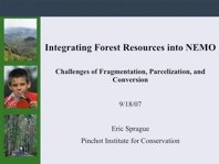 |
Challenges of Fragmentation, Parcelization and Conversion - Eric Sprague, Pinchot Institute for Conservation: What they are, why the exist, and what are the impacts of these threats to the health of our nations forestlands. |
 |
Forests & Watershed Health - Karen Cappiela, Center for Watershed Protection: Research on the connection between forests and watershed health & integrating forests with community planning and site design. |
 |
What Can be Done? -The Baltimore County Story - Don Outen, Baltimore County, MD |
 |
Forestry 101 - Eric Norland, USDA CSREES: An overview of who foresters are and what they do and a description of forestry organizations. |
 |
Measuring & Visualizing Forest Cover- Chet Arnold, UCONN CLEAR: Definitions and examples of ways to measure and evaluate forest cover and forest fragmentation. |
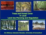 |
Forests & Local Land Use Planning - Finding the Connection- Jim Gibbons, UCONN CLEAR: A reminder about the world of local land use officials, how they think about forests; key considerations and possible actions for local officials in dealing with forest lands, integrating the forest message with more traditional NEMO programming on natural resource based planning. |
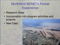 |
Case Study: Northland NEMO's Forest Education Efforts - Jesse Schomberg, Northland NEMO |
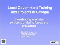 |
Case Study: GA Extension's Efforts to Educate Local Officials About Forests - Liz Kramer, University of Georgia |
 |
Case Study: Cheaspeake NEMO's Forest Presentation - Jonathan Doherty Chessie NEMO |
|
| Forest Publication Links |
| |
University of Minnesota Tree Ordinance Guide - this publication is a guide to tree preservation, protection, replacement and planting during construction activities. |
 |
Carving up the Landscape: CT NEMO Fact Sheet #10 – This is an oldie, but a goodie. While focused on fragmentation of natural lands in general and the impact on wildlife habitat specifically, it still has good suggestions for how to address fragmentation through land use planning – using the typical NEMO approach. |
 |
Forests on the Edge: Housing Development on America’s Private Forests – This is a U.S. Forest Service project that looks at how and where housing development growth is impacting forest lands. The report does a good job of laying out the problem statement – i.e. what is happening and why should we care. |
 |
State of Chesapeake Forests: While focused on the Chesapeake Bay, this publication is widely applicable and relevant. It provides a great overview on the importance of forests as habitat, to water quality, to local economies, etc. It is also discusses how the forest has changed, current threats and what can be done to protect, restore, and manage forest lands. Good background info. |
 |
Conserving Wooded Areas in Developing Communities – This publication is another of the great resources developed by our friends at the Minnesota Department of Natural Resources. It includes recommendations for what communities can do to conserve forests – from land use plans & ordinances at the landscape level to actions at the site and lot level. |
 |
Urban Watershed Forestry Manual, Part I- The Center for Watershed Protection's Guide to measuring, protecting, and improving forest cover in a watershed. |
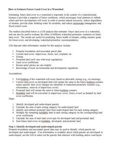 |
Estimating Future Land Cover - A guide from the Center for Watershed Protection on estimating future forest cover in a watershed. |
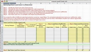 |
Estimating Future Land Cover Worksheet - Companion worksheet to the above guide. |
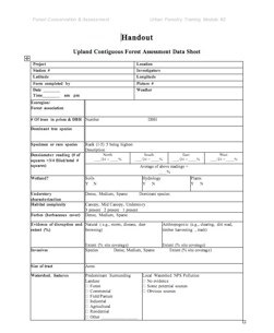 |
Contiguous Forest Assessment Worksheet - The Center for Watershed Protection's method for documenting special habitats/forest tracts to aid in conservation planning. |
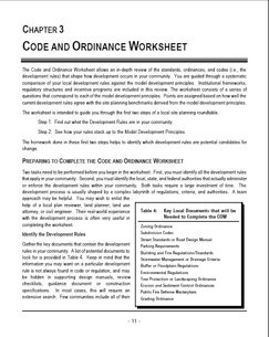 |
CWP's Code and Ordinance Worksheet - A worksheet to look at a community's codes and ordinances for watershed protection - including forest conservation princoples. |
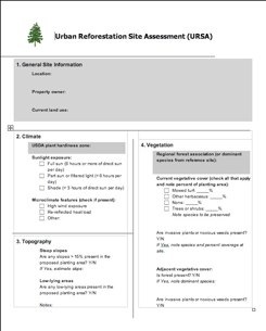 |
Urban Reforestation Site Assessment (URSA) - Center for Watershed Protection's approach to reforestation site selection. |
Back
to Top |
| Forest Geospatial Tools |
- UConn CLEAR’s Forest/Landscape Fragmentation Tool – This tool was developed by the geospatial wizards at UConn to characterize the degree to which natural lands are fragmented by developed landscapes. We have applied the tool to our CT land cover data and have also made it available as a downloadable tool that can be used in ARCGIS or CommunityViz. We hope to include training on the use of this tool in the near future. Follow this link to download the tool and/or learn more about how it works.
Back
to Top |
| FREMO Survey |
FREMO Network Survey Executive Survey - Back in January 2007, the Hub conducted a survey of the Network to determine the level of forest knowledge, activity, and interest within the Network. The document summarizes the results.
Back
to Top |